Pages

Ads 468x60px

Wednesday, December 3, 2014

About Telengana - the 29th State of India

 Telangana MapTelengana is the 29th state of India which became a separate state on 2nd June, 2014. The Telengana was a part of Andhra Pradesh state earlier.  Before India became independent, Telengana region was a part of the state of Hyderabad which comprised two divisions namely Warangal and Medak.  The region was governed by Nizams at that time.  The Telengana has a population of 52,85,757 as per 2011 census which accounted for 41.6% of the population of combined state of Andhra Pradesh.

History of formation of Telengana

The movement to create a separate state of Telangana from Andhra Pradesh had started long back. There had been several movements but the most important ones happened during 1969, 1972 and 2009. Over the years, the movement only gathered a lot of steam.

The process of creating the separate state of Telangana was initiated on 9 December 2009 with a formal announcement from the Indian Government. However, as a mark of protest against this decision, MLAs and MPs from the Rayalseema and Coastal Andhra areas tendered their resignations.

There was a lot of protest after the said announcement.  As a result of this, the Government has put off the process of creating the new state.  on 23 December 2009.  The Telangana movement, however, continued unabated in Hyderabad as well as other districts of the region.

However, the process began again on 30 July 2013 when the Congress party decided to plead with the Indian Government to create the new state of Telangana. It was decided that Hyderabad to be the joint capital of both Telangana and Andhra Pradesh for the next decade. The cabinet has approved the process of creation of Telengana on 3rd October, 2013.


A Group of Ministers (GoM) draft bill on Telangana was approved by the Indian Government on 5 December 2013, following which the bill was submitted to the Parliament so that both the houses could vote on the same. The 15th Lok Sabha voted in favour of creating a new state on 18 February 2014 and the Rajya Sabha followed suit on 20 February 2014.

Pranab Mukherjee, the President of India, provided his consent to the decision on 1 March 2014 and the Gazette notification for the same was brought out on the same day. It was announced by the Indian Government on 4 March 2014 that the new state of Telangana would be created and hence it was formed on 2 June 2014.

Sunday, September 14, 2014

Districts of Andhra Pradesh

Andhra Pradesh after bifurcation on 2nd June, 2014 has now 13 districts.  There were 23 districts in the combined Andhra Pradesh.  After separation of Telengana as a separate state with 10 districts, Andhra Pradesh has now 13 districts.  Now Andhra Pradesh is one of the 29 states of India. Ananthapur district is the largest district in Andhra Pradesh and Srikakulam is the smallest district.  The total districts of Andhra Pradesh are divided into two regions.


  • The Coastal Andhra comprises of 9 districts namely, Srikakulam, Vizianagaram, Visakhapatnam, East Godavari, West Godavari, Krishna, Guntur, Prakasham  and  Sri Potti Sriramulu Nellore.  
  • The Rayala Seema region comprises of 4 districts - Kurnool, Chittor, YSR Kadapa and Ananthapur districts.


Here is the list of districts of Andhra Pradesh.


1. Srikakulam District :   The Srikakulam district has the longest coast line in Andhra Pradesh..  Nagavali and Vamsadhara rivers flows through this district.  The Srikakulam district was created out of part of Vishakapatnam district on 15th August, 1950. 


The district was situated between 83º 25' and 84º 50'E, of the eastern longitudes and 18º 20' and 19º 10'N, of northern latitudes. The boundaries of this district are Bay of Bengal in the East, Vijayanagaram district in the South and Orissa state borders in the West and North directions. The district has population of 26,99,471 as per the 2011 census .
Head Quarters: Srikakulam


2. Vizianagaram District :  If India is a land of precious stones, one such jewel embedded on Indian soil is the Vizianagaram district.    The battle of Bobbili and the battle of Padmanabham are unforgettable and make the area the land of pride and valour.  The district is  situated between 83º 0' and 83º 45'E, of the eastern longitudes and 17º 15' and 19º 15'N, of northern latitudes. The Boundaries of this district are Srikakulum district in the East, Vijayanagaram district in the South, Orissa state and Vishakapatnam district in the West and Orissa state in the North directions. The district has population of 23,42,868 as per the 2011 census. 

Head Quarters: Vizianagaram

3. Visakhapatnam District :  Visakhapatnam is a coastal city also called as the "Jewel of the East Coast". situated in Andhra Pradesh.  The Visakhapatnam is situated on eastern coast of India, and nestled among the hills of Eastern Ghats and facing the Bay of Bengal to the east. 
Visakhapatnam is the largest city in Andhra Pradesh with an area of 550 square kilometers and is an industrial city apart from being aport city.  It is the head quarters of Eastern Naval Command.  The district is situated between 81º 06' and 83º 31'E, of the eastern longitudes and 17º 15' and 18º 32'N, of northern latitudes. The boundaries of this district are Bay of Bengal in the East, East Godavari district in the South, Orissa state in the West and North directions. The district has population of 42, 88,113 as per the 2011 census.  
Head Quarters: Visakhapatnam


4. East Godavari district :  The East Godavari is a district in Coastal Andhra region and the district Head Quarters is located at Kakinada. The district is the most populous district in Andhra Pradesh with a population of 51,51,549 as per 2011 census. Rajahmundry and Kakinada are the largest two cities in this district.   The East Godavari is also called as Rice Bowl of Andhra Pradesh with lush paddy fields and coconut groves.
East Godavari district has a total area of 10,807 sq. kilometers.  This district is a residuary portion of the old Godavari district after separation of West Godavari in 1925.  East Godavari is closely associated with the river Godavari.  The district has 5 revenue divisions, 60 revenue mandals and 1012 Grama Panchayats.  

East Godavari district is situated between 81º 30' and 82º 36'E, of the eastern longitudes and 16º 30' and 18º 20'N, of northern latitudes.  The boundaries of the districts are Visakhapatnam district and Orissa state on north side, the Bay of Bengal on east side, the West Godavari district on west side, and Khammam district on north west.
Head Quarters: Kakinada

5. West Godavari district :  This is one of the 13 districts of Andhra Pradesh lying in coastal andhra region.  The district headquarters is located at Eluru.  The district population is 39,34,782 as of 2011 census. The total area of this district is 7,742 sq. kms. 

The West Godavari is extremely fertile, getting water abundantly through out the Cotton barrage built on the Godavari River at Dhavaleswaram.  Topographically the district is divided into the Delta and the uplands.  

Agriculture, coconut and rice are cultivated in delta region.  The district is popularly known as the Granary of India since about 50% of the state's rice production comes from this district.  Oil palm, sugar cane, mango, banana and other fruits as well as tobacco and cotton are produced in the uplands region. Prawns and fish are exported to Japan and USA from the coastal belt of the district.  Eluru is the largest city in West Godavari district with woolen carpet industry.  Tadepalligudem is the biggest market center and is the geographical center of the district. The Tanuku has Andhra Sugars. 


Head Quarters: Eluru


6. Krishna district :  This is one of the 13 districts of Andhra Pradesh lying in coastal andhra region.  The district headquarters is located at Machilipatnam.  The district population is 45,29,009 as of 2011 census. The total area of this district is 8,727 sq. kms. 

Krishna District with its headquarters at Machilipatnam was formerly called Machilipatnam District.  Later on it was renamed as Krishna district by adding certain taluks of the abolished Gutur district in 1859 with Machilipatnam as its headquarters. It was named after Krishna river which is the third longest river in India.  The river flows in Andhra Pradesh before it empties itself into Bay of Bengal near Hamsaladevi village in Krishna district.

The borders of Krishna District are West Godavari district in east, Bay of Bengal in the south, Guntur district and Nalgonda district ( Telengana state )  in West and Khammam district ( Telengana state )  in north directions. 

The population of the Krishna District is 41,81,071 persons.  Among these persons, the males are 21,16,018 in numbers while females are 20,65,053 in numbers. The sex ratio is 961 females per 1000 males.

The Krishna district is endowed with a rich variety of soils and it occupies very important place in agriculture, which is the most important occupation in the district.  Paddy is the main food crop produced in this district.  The literacy rate of Krishna district is 70.03 %  which indicates that the district is well advanced in the field of education.  

Vijayawada is the major city in Krishna district and it has an important railway junction which is connected to Delhi, Calcutta, Chennai, Hubli, Gudiwada and Machilipatnam.  The largest bus station in the state is also located in Vijayawada.


The Krishna district has a large number of Tourist Spots like:
  • Bhavani Island Leisure Spots Vijayawada
  • Gandhi Hill Monuments Vijayawada
  • Ghantasala Buddhist Centres Ghantasala
  • Hazrat Bal Mosque Pilgrim Centres Vijayawada
  • Jaggayyapeta Buddhist Centres Jaggayyapeta


Head Quarters: Machilipatnam

There are totally 13 districts...  the information about other districts will be posted soon...


Sunday, August 24, 2014

Andhra Pradesh after bifurcation

Andhra Pradesh State which was combined state until 31st May, 2014 was bifurcated into two smaller states - Telengana and Andhra Pradesh.   The Andhra Pradesh Reorganization Act 2014 bill was passed in Parliament in February, 2014 for formation of Andhra Pradesh ( with 13 districts ) and Telengana ( with 10 districts ) with effect from 2nd June, 2014.  Hyderabad is going to be the common capital for both the states for 10 years.


Andhra Pradesh is one of the 29 states of India, situated on the country's southeastern coast. The Andhra Pradesh is the eighth largest state in India covering an area of 160,205 km2 (61,855 sq mi).  According to 2011 census, the state is tenth largest by population with 49,386,799 inhabitants. The state borders Telangana in the northwest, Chhattisgarh in the North, Odisha in the northeast, Karnataka in the west, Tamil Nadu in the south and the water body of Bay of Bengal in the east. A small enclave of 30 km2 (12 sq mi) of Yanam, a district of Pondicherry, lies in the Godavari delta to the northeast of the state.

Andhra Pradesh has the second longest coast line of 972 Km in India.  This is second to Gujarat as far as coast line is concerned.   Andhra Pradesh comprises of two regions - The coastal andhra and the Rayala Seema.  So the news media often refers this state as Seemandhra.   There are 13 districts in Andhra Pradesh ( 9 in coastal andhra and 4 in Rayala Seema areas ).  Vishakapatnam is the largest city in Andhra Pradesh and also the commercial hub of the state with a GDP of $26 billion followed by Vijayawada with a GDP of $3 billions.  Some of the other commercial hubs in Andhra Pradesh include - Kurnool, Tirupathi, Guntur, Kakinada, Rajahmundry.  At present ( 25th August, 2014 ) Vijayawada is the Ad Hoc capital of Andhra Pradesh.


Geography of Andhra Pradesh

The geography of Andhra is bestowed with two mightly river systems of Krishna and Godavari.  The Andhra Pradesh state has a variety of physio-geographic features ranging from Eastern Ghats, Nallamala forest, Coastal plains to deltas of two major rivers - Krishna and Godavari.
Andhra Pradesh is the largest producer of Rice in India so it is nick named as Rice bowl of India. The official language of Andhra Pradesh is Telugu.  The state has various piligrimage destinations like Tirumala temple.  The India's space port - Satish Dhawan Space Center is located at Sriharikota in Andhra Pradesh

 The Eastern Ghats are discontinuous and individual sections have local names. The Eastern Ghats are a major dividing line in the state's geography. The Kadapa Basin formed by two arching branches of the Eastern Ghats is a mineral-rich area. The Ghats become more pronounced towards the south and extreme north of the coast. Most of the coastal plains are put to intense agricultural use. The Rayalaseema region has semi-arid conditions.

The state of Andhra Pradesh will be bifurcated into two states, named as Telangana and Andhra Pradesh. The Andhra Pradesh Reorganisation Act, 2014 bill was passed in February 2014, in favour of the formation of the state of Telangana, which would comprise of 10 districts from north-western Andhra Pradesh. The new state shall come into existence from 2 June 2014 as the 29th state of India, after the President of India's approval. Both the states would have Hyderabad as its capital for ten years. 

After the formation, Telangana would have 17 Lok Sabha and 119 assembly constituencies. The elections for the Lok Sabha and assembly seats took place in 2014. Andhra Pradesh will send 42 members to the Lok Sabha. 


History of Andhra Pradesh

Centuries ago, Andhra Pradesh was a major Buddhist centre and part of Emperor Ashoka's sprawling kingdom. Not surprisingly, traces of early Buddhist influence are still visible in several places in and around the state. After the death of Emperor Ashoka, the Satavahanas established their kingdom in this region. During the 7th century, the Chalukyas held sway over Andhra Pradesh until the 10th century, when the Cholas seized power. In the 14th century, Muslim power reached this southern state and for centuries ruled over this princely state, and finally was taken over by a General of the Mughal Emperor Aurangzeb in 1713. 

Saturday, August 23, 2014

RBI planning to introduce plastic currency

There is a news that the Reserve Bank of India (RBI) is planning to introduce plastic currency notes next year on a pilot basis and improve security features to defeat the efforts of counterfeiters. It also aims to set up a national bill payments system that could eliminate middlemen and bring in efficiencies.

There is a news that tender bids have come for 1 billion notes.   And pilot testing would be done in five cities including Shimla.   Based on pilot testing, the currency will be introduced in 2015. 

This is a news published in the Economic Times news paper.   Read the full article.  

Prime Minister Narendra Modi takes thin delegation on foreign trips to cut costs

It's not just the media contingent that Prime Minister Narendra Modi has avoided on his foreign tours. Modi has been keeping his own delegation thin as well, dropping officials and ministerial colleagues from the trips.

A delegation of 42 accompanied Modi to Nepal on August 3-4, according to information available with ET. The team comprised top officials, personal secretaries, attendants and security officials. The delegation for his four-day visit to Japan beginning Augu .. 
beginning August 31 is also expected to be of similar size, but is likely to include a minister as key deals are expected to be signed during that visit, government sources told ET.


Modi's predecessor, Manmohan Singh, often carried teams that had about 70 members, excluding the media party, on trips that were for two days. "The trimmer delegation is in keeping with the PM's direction for cutting costs given the condition of the Indian economy," an official well versed with the mater said.

Singh, on his last trip as PM to Myanmar for the BIMSTEC Summit on March 3-4, took an official delegation and accompanying delegations comprising several officials from the Prime Minister's Office, secretaries, spokesperson, Press Information Bureau officers and a host of private secretaries, personal physicians and two cooks, government source said. Singh who had heart ailments avoided outside food on many .. 


Telengana - 29th State of India formed on 2nd June, 2014

The 29th state of India was formed on 2nd June 2014 after Bifurcation of Andhra Pradesh state into two states - Telengana and Andhra Pradesh.


The Congress Working Committee unanimously passed a resolution on 30th July, 2013 to recommend the formation of a separate state of Telengana by bifurcating the state of Andhra Pradesh.  After various stages the bill was passed in the Indian parliament in February, 2014. The Andhra Pradesh Reorganization Act 2014 bill was passed by the Parliament of India for formation of the 29th state of India - Telengana state.  The bill received the assent of the President of India and published in the Gazette on 1st March, 2014.

Sri K.Chandra Sekhar Rao was elected as the first Chief Minister of Telengana State and sworn in as Chief Minister on 2nd June, 2014.  Hyderabad will remain the joint capital city for both Telengana and Andhra Pradesh States for a period of 10 years.

The Telengana state has an area of 114,840 Sq. Kilometers and is the 12th largest state of India.  The state has a population of 3,52,86,757 as per 2011 census.

Saturday, March 8, 2014

Indian States and Union Territories

India is a union of a number of states and union territories.  It is a Sovereign Socialist Secular Democratic Republic with Parliamentary System of Government.  The Indian Republic is governed in terms of the constitution, which was adopted on 26th November, 1949 and came into force on 26th January, 1950.   At present as on today, India has 28 States and 7 Union Territories.


The States Reorganization Act of 1956 was an important force in reorganizing the boundaries of various States of India along linguistic lines, and bringing an amendment in Indian Constitution where by 3 types of states, known as Parts A, B and C states were amended with single type of state.   

3 new states were formed in November, 2000 - Chattisgarh was carved out of Madhya Pradesh.  Uttaranchal was carved out from Uttar Pradesh and Jharkhand out of Bihar.  The Indian Constitution distributes the legislative powers between the Parliament and State legislatures.  The Indian Parliament comprises of two houses - lower house is known as Lok Sabha ( House of People ) and the upper house is called as Rajya Sabha ( Council of States ).  At State level, some legislatures are bicameral and are run along the lines of the two houses of national Parliament.

India blessed with natural beauty, population, religions, cultures, languages has 28 states and seven union territories.   Each state and union territory is unique in its own way.   Here is a list of all Indian States and Union Territories as on today listed along with capital cities.

States of India

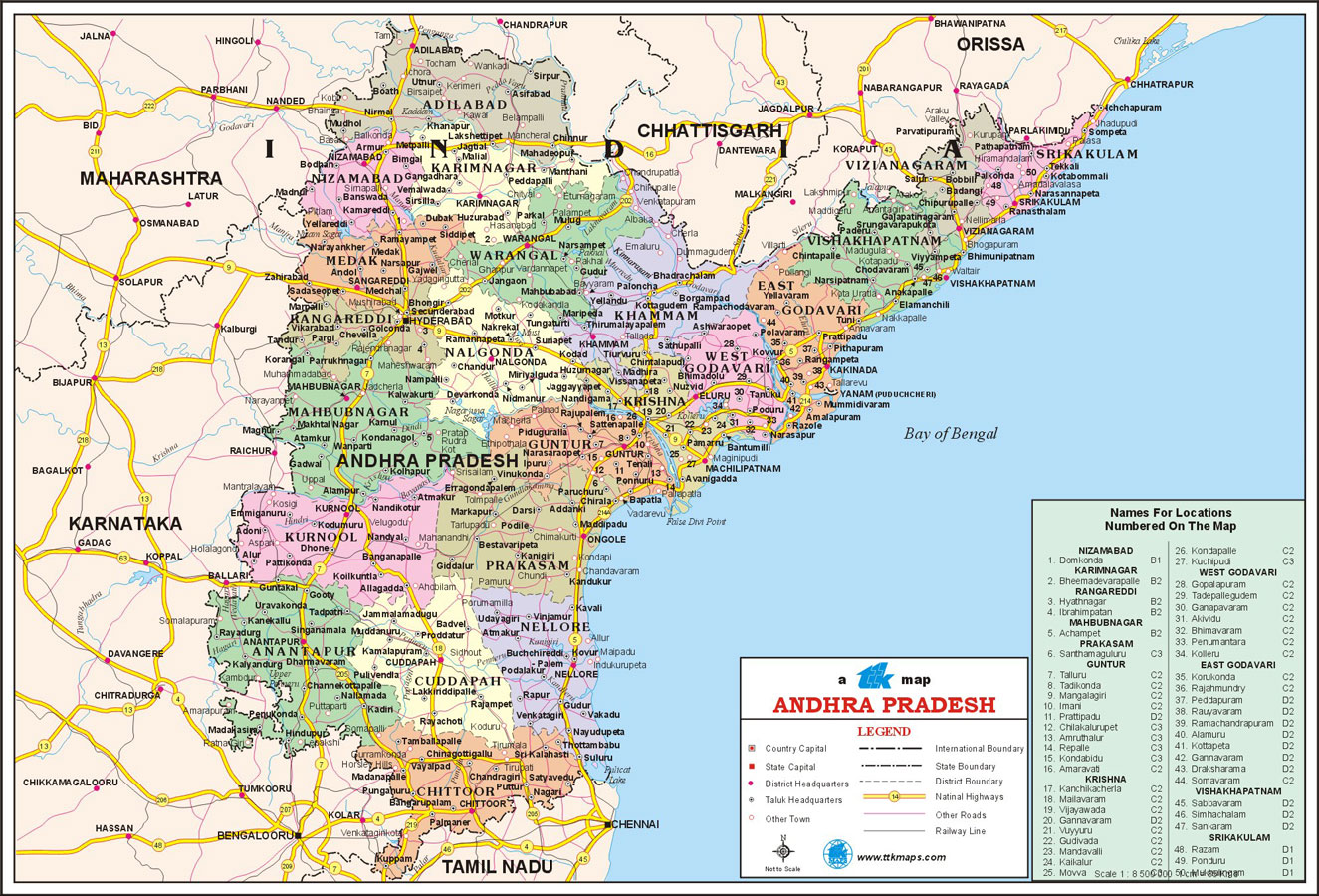
  • Andhra Pradesh - Hyderabad
  • Arunachal Pradesh - Itanagar
  • Assam - Dispur
  • Bihar - patna
  • Chattisgarh - Raipur
  • Goa - panaji
  • Gujarat - Gandhi Nagar
  • Haryana - Chandigarh
  • HImachal Pradesh - Shimla
  • Jammu & Kashmir - Sri Nagar (Summer),  Jammu (Winter)
  • Jharkhand - Ranchi
  • Karnataka - Bengaluru
  • Kerala - Trivandrum
  • Madhya Pradesh - Bhopal
  • Maharashtra - Mumbai
  • Manipur - Imphal
  • Meghalaya - Shillong
  • Mizoram - Aizawl
  • Nagaland - Kohima
  • Odisha - Bhubaneshwar
  • Punjab - Chandigarh
  • Rajasthan - Jaipur
  • Sikkim - Gangtok
  • Tamil Nadu - Chennai
  • Tripura - Agartala
  • Uttar Pradesh - Lucknow
  • Uttar Khand - Dehradun
  • West Bengal - Kolkata


Union Territories of India

  • Andaman & Nicobar islands - Port Blair
  • Chandigarh - Chandigarh
  • Dadar Nagar haveli - Silvassa
  • Daman and Diu - Daman
  • Delhi - Delhi
  • Lakshadweep - Kavaratti
  • Pondicherry - Pondicherry


Here is a  brief about some of the popular states and Union Territories of India.

Goa

Situated in the Malabar Coast of India Goa is the best beach resort in India. Populated with a mix of Christians and Hindu's Goa's culture is unique in its own kind. Known as the most happening states in India Goa is home to fun loving and easy going people. The major attraction in the state is its long stretches of pristine beaches. Some of the important beaches in Goa are; Colva, Vagator, Calangute, Harmal, Anjuna and Miramar and Baga.

Andaman and Nicobar Islands

Popular as the Emerald Isles the Andaman and Nicobar islands situated in the Bay of Bengal.  It is  one of the popular tourist's destinations in India. The union territory is home to numerous aboriginal tribes and two distinct native cultures the Negrito and the Andamans. Known to be a friendly and cheerful lot of people the population of Andaman and Nicobar islands enjoy festivities such as Panguni, Pongal, Shivratri, Uthiram, Janmastami etc. Some of the popular tourist spots in the union territory include National Memorial, Marine Museum, Naval Marine Museum, Smrithika Museum, Haddo Zoological Garden.

Andhra Pradesh

Located in the southern region of India, Andhra Pradesh happens to be the third largest state in the country. Reputed for its distinct culture and fine arts Andhra Pradesh is mostly dominated by Telugu speaking people. The important festivals celebrated in the state are Dasara, Deepavali, Sri Ramanavami, Vinayaka Sankranti and Chavithi. The places which are a definite must see in the state include Nehru Zoological Park, Hussain Sagar Lake, State Museum and Art gallery, Salarjung Museum, Ethurnagaram sanctuaries etc.

 Arunachal Pradesh

Ranked as the most charming state in India Arunachal Pradesh is characterized by lofty mountains and snow clad peaks. Home to numerous tribes and sub tribes the population of Arunachal Pradesh consists mostly of people of Asiatic origin. The one thing that is unique about the state is its belief in animism. Beautiful as it is the state is home to several popular tourist hubs like Sinyi Bomdila, Tawang and Gyaker.

Assam (Asom)

Situated in northeastern India Assam abounds in natural beauty. The population of Assam is said to be a mix of people of Tibetan, Aryan, and Burman origins. The population of Assam is made up of numerous tribes who believe in celebrating all the religious festivals with equal vigor. However the one festival that is most popular in Assam is Bihu. Assam over the years has also developed into an important tourist destination with attractions such as Gandhi Mandap, Kamakhya Temple, Umananda, Nabagraha (Temple of nine planets), State Zoo, State Museum etc.

Dadra & Nagar Haveli

Lying in close proximity to the west coast of India Dadra & Nagar Haveli is home to a mass of shy and simple Adivasis. Evolving as an important hub for tourist this union territory houses numerous tourist attractions like The Tribal Cultural Museum, Khanvel, The Vanganga Lake and Island Garden.

Bihar

Situated in Eastern India, Bihar boasts of a rich cultural heritage that dates back to ancient India. The people of Bihar are lively and co exists in peace and harmony. The locals are known as Bihari's and festivals celebrated in the state include Buddha Purnima, Saraswati Puja, Eid-ul-Fitr, Holi, Rath yatra, Maha Shivaratri and Mahavir Jayanti.

Apart from these the other states and union territories in India are Chhattisgarh , Gujarat, Haryana, Himachal Pradesh, Jammu and Kashmir, Jharkhand, Karnataka, Kerala, Madhya Pradesh, Chandigarh, Maharashtra, Manipur, Meghalaya, Mizoram, Nagaland, Orissa, Punjab, Rajasthan, Sikkim, Tamil Nadu ,Tripura , Uttarakhand , Uttar Pradesh and West Bengal.

Uttaranchal is the latest introduction to the Indian states list and is foreseen as a booming industrial region in the next few decades.

States like Manipur, Sikkim, Meghalaya, Mizoram and Nagaland are known for their distinct culture which is very different from the rest of the country. The popular festivals celebrated in these regions include; Sekrenyi, Moatsu, Tuluni in Nagalanad, Ka Pomblang Nongkrem in Meghalaya, Chapchar Kut and Pawl Kut in Mizoram. Sikkim celebrates most of the Hindu and Buddhist festivals that are celebrated across the country and Ingol Chakouba and Yaoshang in Manipur.

Chandigarh, Jammu and Kashmir and Haryana situated in the northern part of India are known for their natural beauty and serve as ideal tourist destinations in the country. Janmastami, Idul Fitr, Lohri and Diwali are the common festivals celebrated with much enthusiasm in these parts of the country.

The southern part of India comprising Karnataka, Kerala, and Tamil Nadu is of prime importance from the tourism point of view as these places attract millions of tourists from different parts of the globe.

Other important Indian states that have still manage to preserve the cultural heritage of the country include; Uttar Pradesh, Punjab, Rajasthan, West Bengal Madhya Pradesh Maharashtra, Gujarat and Himachal Pradesh.

Friday, March 7, 2014

United Andhra Pradesh - the first linguistic state of India


Andhra Pradesh is one of the state of the country, which takes pride in its rich historical and cultural heritage. A peek into the History of Andhra Pradesh can give an idea of the glorious past the state has witnessed. 


Andhra Pradesh is the first State formed based on linguistic basis.  Let us see a brief history of Andhra Pradesh.

The origin of Andhra Pradesh

 The historians believe that the Andhra Pradesh people were Aryans.  These people migrated to the south of Vindhyas and they mixed up with other races.  Andhra Pradesh which was a major part of Emperor of Ashoka's kingdom was an important Buddhist center of that time. Many places of the state still bears the traces of the Buddhist culture and influence.


The earlier period

One of the earliest dynasty which ruled Andhra Pradesh is the Satavahana dynasty.  This was during the second century B.C and they were also known as Andhras.  The capital city at that time was Amaravathi which was on the banks of river Krishna. They promoted national and international trade and were great followers of Buddhism. After the end of the Satavahana reign, the state was ruled by the Pallavas, the Chalukyas, the Cholas and the Kakaityas respectively. 

The Kakatiya dynasty was uprooted in 1323.  Their ruler was captured by Tughlak Sultan of Delhi.  After the end of Kakatiya dynasty, some local kingdoms rose to power in different parts of the kingdom.  One of those was the Vijayanagar Kingdom was the most powerful.  King Krishnadeva Raya belonged to this kingdom.  The Vijayanagar kingdom was finally captured by Mulsim invaders.    The Qutb Shahi dynasty was seen by the state in middle of 16th century.  They were defeated by the Mughals, to be precise by Aurangazeb's son.  

Hyderabad was declared independent in 1707 and went under the rule of the Nizams.  The Nizams were great allies of the British and they helped the Europeans to defeat Tipu Sultan of Mysore.


The post independence period

Andhra Pradesh became the first state to be formed on basis of language after independence. 21 districts were given to Telugu speaking people out of which nine were in the Nizam's dominions and the rest are in Madras Presidency.  But after an agitation in 1953, 11 districts of the Madras presidency were taken out to form a new Andhra State with Kurnool as the capital. Nine districts under the Nizam rule were later added to form the combined Andhra Pradesh in 1956.  Hyderabad became the capital of the new Andhra Pradesh State.  Hyderabad was one of the most technologically advanced cities of modern India.